
Heavy rain brought serious flooding across parts of the Southern U.S. on Saturday, where rapidly rising floodwaters inundated roadways and spurred some evacuations. Meanwhile, snow and sleet made for messy weather in the Northeast and Mid-Atlantic.
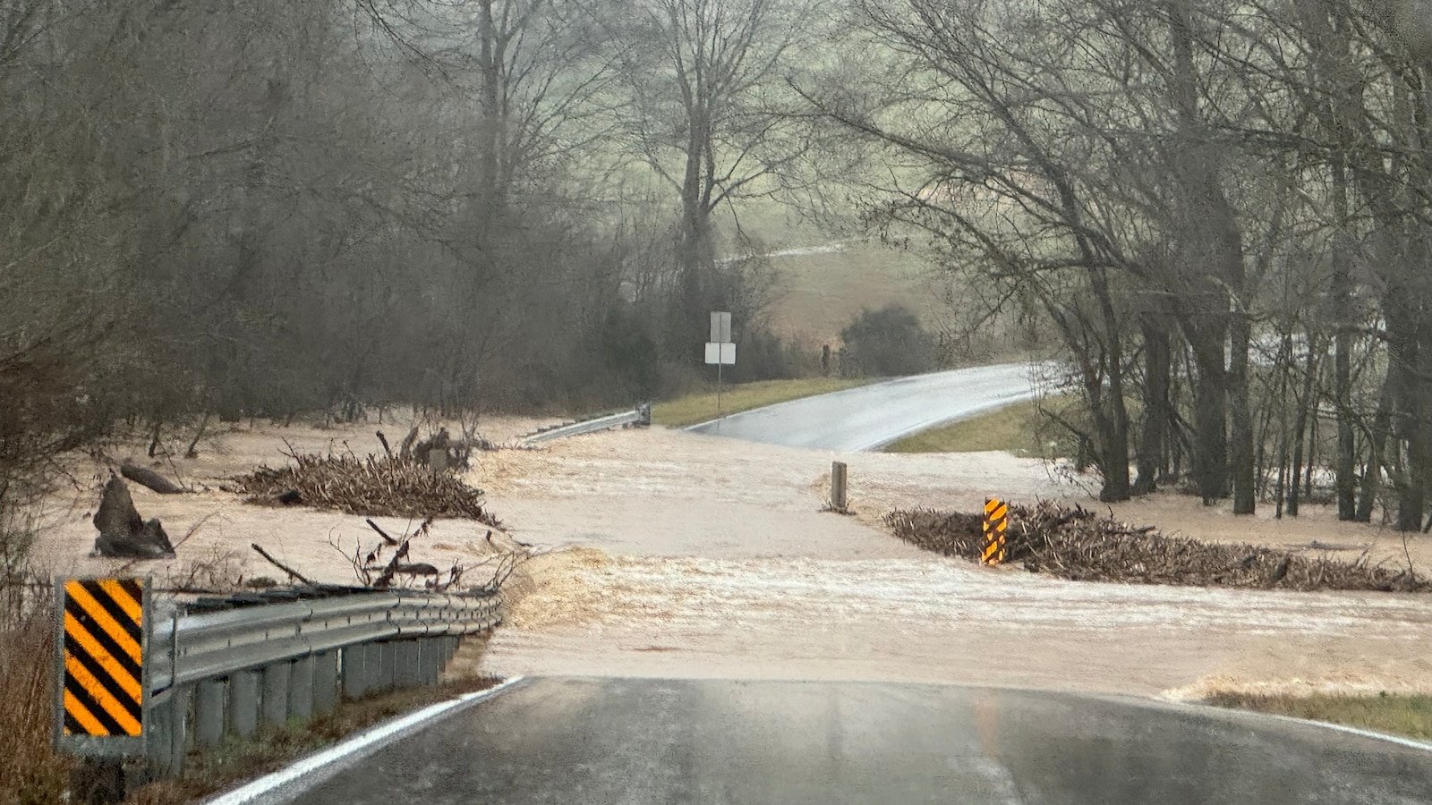
Throughout Saturday and into the overnight hours, there were numerous Flash Flood Warnings stretching across parts of Kentucky, Tennessee, West Virginia and North Carolina.
In Kentucky, where Gov. Andy Beshear issued a state of emergency in advance of the heavy rainfall, areas across the state saw widespread flooding throughout the day. The entire state “is under significant threat from midnight to 4 a.m.,” Beshear said in a post on X on Saturday afternoon.

Heavy rain led to flooding in southern Barren County, Kentucky, on Feb. 15, 2025.
Courtesy Kayla McCandless
Serious flooding around Panbowl Lake in Jackson — about 85 miles southeast of Lexington — led to the evacuation of a nursing home and a hospital as precautions.
In Tennessee, more than 50 residents of a nursing home in Macon County, about 65 miles northeast of Nashville, were evacuated to higher ground after rising water began to approach, according to the Macon County Emergency Medical Services.

A car submerged on Jackson Bridge Road in Bowling Green, Kentucky, on Feb. 15, 2025.
Courtesy Brittnay Dorris
The National Weather Service extended a flash flood emergency for several counties in West Virginia and in southwestern Virginia until 8 a.m. Sunday, calling the flash flooding an “extremely dangerous and life-threatening situation.”
In the town of Richlands, in southwestern Virginia’s Tazewell County, residents of many areas were being encouraged to evacuate, according to the local police department.

Flooding on Mary Road in Campton, Kentucky, on Feb. 15, 2025.
Courtesy Rebecca Miller Spencer/Facebook
“Multiple areas of the town are currently experiencing flooding, with the river expected to rise even higher,” the police department said in a Facebook post Saturday afternoon. “Residents in previously flooded areas are strongly advised to evacuate at once. Evacuation should not be postponed.”

Storms with damaging winds and flash flooding were the main threats, but there was also the possibility of a few tornadoes. Residents were urged to pay attention to severe weather warnings overnight, as the tornado risk continued into nighttime.

Snow and ice in the Northeast
Meanwhile, snow moved into portions of the Northeast and Mid-Atlantic Saturday afternoon, and conditions were expected to deteriorate as snow picks up and the sun goes down.
Not just a pure snowstorm, there was expected to be a changeover to sleet and rain as this system moves through the northeast into Sunday.

A man walks along a path in Overpeck County Park as snow falls in Leonia, NJ, Feb. 15, 2025.
Anne-Marie Caruso/NorthJersey.com via USA Today Network via Imagn Images
At the same time, some areas that had been seeing snow will be switching over to sleet and rain, creating slushy conditions and hazardous travel.
By 10 p.m., warmer air continues to surge northward, causing New York City to switch over to sleet and then rain.
By 3 a.m. on Sunday, the northeast radar begins to resemble Neapolitan ice cream, with layers of snow, ice, and rain across New England.
Snow totals could be topping a foot across parts of central and northern New England and northern New York State. For cities like Hartford and Boston, a slushy 3”-6” is likely before rain comes in and compacts that snow a bit.
86 million under wind alerts
High wind alerts are in effect for more than 86 million people across 22 states for Sunday and Monday.
As the major winter storm moves out, wind gusts could reach 50 to 60 mph across parts of the south into the northeast